NC High Country Bike Trails
NC High Country Bike Trails
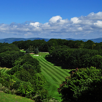
Whether you are training on the Blue Ridge Mountains, mountain biking, or just want to take a leisurely ride through the country to admire the mountains, the High Country is a great place to pedal. Our cool temperatures, fresh air and bike friendly communities are here to welcome you!
Here is a list of trails by difficulty:
EASY BIKE RIDES
These trails have low elevation gains and nice scenery
- GREENWAY TRAIL- BOONE
Length: 6 Miles (3 mile turnaround)
Condition: Maintained gravel, dirt trail and dirt road
This gentle outing, which travels the length of the Lee & Vivian Reynolds Greenway Trail in Boone is perfect for a quick leisurely ride. For trail map, Click Here - HOWARD’S CREEK ROAD LOOP- BOONE
Length: 16 Miles
Elevation: 600 foot gain
Start at the Junaluska City Park and bike through beautiful farmland and forested roadways - WATAUGA RIVER ROAD RIDE- VALLE CRUCIS
Length: 8 Miles (4 mile turnaround)
Condition: Maintained paved and gravel road
Elevation: 150 foot gain
Park at the bridge and enjoy a beautiful leisurely bike ride along the scenic Watauga River in Valle Crucis. - LOWER CHINA CREEK LOOP- BLOWING ROCK
Length: 3.9 Miles
Condition: Easy, dirt, single-track trail
Elevation: 250 foot gain
This trail follows the thunderous and beautiful Thunder Hole Creek through the woods. Located off Globe Road in Blowing Rock. - RAILROAD GRADE ROAD- TODD
Length: 10 Miles
Condition: Maintained, Paved
Elevation: Flat
Ride this flat road along the New River. Check out the Todd General Store for a nice rest stop!
MODERATE BIKE RIDES
Rides contain significant elevation changes
- JUNALUSKA ROAD RIDE- BOONE
Length: 14 Mile Loop
Condition: Dirt Road
Elevation: 1,200 foot gain
Swings along the steep Junaluska Mountain - EIGHTEEN MILE ROAD- WILSONS CREEK, PISGAH NATIONAL FOREST
Length: 16 Miles
Condition: Maintained dirt forest service road
Elevation: 600 foot gain
Lack of hairpin turns and rough terrain will allow you to pick up some speed on this road. Click Here for information on the Wilson's Creek Wild & Scenic River Area
STRENUOUS BIKE RIDES
Rides contain significant elevation changes, roads may be in rough condition
- YANCEY RIDGE LOOP- WILSONS CREEK, PISGAH NATIONAL FOREST
Length: 8.2 Miles
Condition: Erosion has left behind some serious ditches on this old logging road
Elevation: 1,100 foot gain
Click Here for information on the Wilsons Creek Wild & Scenic River Area - ROSEBOROUGH TRAIL- WILSONS CREEK, PISGAH NATIONAL FOREST
Length: 14.1 miles
Condition: Single-track, paved road. Classic Mountain-Bike Ride
Elevation: 1,600 foot gain
Click Here for information on the Wilsons Creek Wild & Scenic River Area - LOWER WILSON RIDGE TRAIL- WILSONS CREEK, PISGAH NATIONAL FOREST
Length: 8.6 miles
Condition: Single-track old dirt logging road. Some sections on trail are not clearly marked.
Elevation: 600 foot gain
Click Here for information on the Wilsons Creek Wild & Scenic River Area - WISEMAN’S VIEW RIDE- LINVILLE GORGE WILDERNESS AREA
Length: 8.2 miles
Condition: Rough dirt road, very steep elevation gains
Elevation: 1,200 foot gain
Click Here for information on the Linville Gorge Wilderness Area - TABLE ROCK LOOP- LINVILLE GORGE WILDERNESS AREA
Length: 26.2 miles
Condition: Dirt & paved road, very few level spots
Elevation: 2,450 foot gain. Most elevation gain occurs within 11 paved miles
Click Here for information on the Linville Gorge Wilderness Area - LINVILLE GORGE LOOP- LINVILLE GORGE WILDERNESS AREA
Length: 49 miles
Condition: Dirt & paved roads. Steep climbs & steep descents
Elevation: 4,050 foot gain. Toughest ride in the area
Click Here for information on the Linville Gorge Wilderness Area
COUNTY MAINTAINED MOUNTAIN BIKING AREAS
- ROCKY KNOB MOUNTAIN BIKE PARK- BOONE
Length: 6-8 miles of trails
Click Here for a map of trails - EMERALD OUTBACK- BEECH MOUNTAIN
Length: over 9 miles of trails
Click Here for a map of trail
Visit our FACEBOOK PAGE